Planning the Camino Francés stages looks straightforward until weather, elevation, accommodation, and your increasingly argumentative feet enter the conversation. The complete Camino Francés route stretches approximately 764–790 kilometers (475–491 miles) from Saint-Jean-Pied-de-Port to Santiago de Compostela and is commonly divided into about 33 walking stages.
It normally begins in Saint-Jean-Pied-de-Port, France, crosses the Pyrenees into Spain, and continues west toward Santiago de Compostela.
Along the way, the route passes through Pamplona, Logroño, Burgos, León, Astorga, Ponferrada, Sarria, and dozens of smaller towns that may eventually mean more to you than the famous cities.
Most Camino Francés guides make the route look wonderfully straightforward.
Walk here.
Sleep there.
Repeat until Santiago.
That information is useful, but it is not exactly how the Camino works.
The Camino is less like a carefully produced travel documentary and more like a punk show in somebody’s basement. There is a general structure, everyone has some idea where the evening is supposed to end, but something unexpected will almost certainly happen before you get there.
| Camino Francés overview | Details |
|---|---|
| Starting point | Saint-Jean-Pied-de-Port, France |
| Finish | Santiago de Compostela, Spain |
| Total distance | Approximately 764–790 km (475–491 miles) |
| Traditional stages | Approximately 33 stages |
| Typical duration | 33–40 walking days |
| Slower itinerary | 40–60 days |
| Major regions | Navarra, La Rioja, Castilla y León, Galicia |
| Minimum final section | Sarria to Santiago, slightly more than 100 km (62 miles) |
| Best-known challenge | Pyrenees crossing from Saint-Jean-Pied-de-Port |
I learned that planning the Camino Francés is necessary.
I also learned that following a plan too rigidly can make the journey considerably harder than it needs to be.
Sometimes, the best way I can help another traveler is by admitting where my own plans went sideways. Learn from my mistakes, and perhaps your feet will send me a thank-you card from somewhere near Burgos.
This Camino Francés guide covers the route, traditional stages, daily distances, rest days, accommodations, and the mistakes that can quietly dismantle a carefully planned pilgrimage.
Most importantly, it leaves room for the greatest Camino lesson of them all:
Your itinerary is a guide.
It is not a legally binding contract with your feet.
- What Is the Camino Francés?
- Where Does the Camino Francés Start?
- Camino Francés Route at a Glance
- Section One: Crossing the Pyrenees
- Section Two: Navarra and La Rioja
- Section Three: La Rioja to Burgos
- Section Four: Crossing the Meseta
- Section Five: León, Astorga, and Cruz de Ferro
- Section Six: El Bierzo and the Climb to O Cebreiro
- Section Seven: The Final Walk Through Galicia
- Traditional Camino Francés Stages
- Why I Would Not Blindly Follow the Traditional Stages
- A Slower Camino Francés Strategy
- How Long Does the Camino Francés Take?
- How to Plan Your Camino Francés Stages
- Where to Schedule Rest Days
- How Often Should You Rest?
- Booking Accommodations
- Common Camino Francés Planning Mistakes
- What to Carry for the Camino Francés?
- Training for the Camino Francés
- When to Walk the Camino Francés
- Creating Your Own Camino Francés Itinerary
- Atypical Last Thoughts
What Is the Camino Francés?
The Camino Francés, also known as the French Way, is the best-known route within the larger Camino de Santiago network.
The most common modern starting point is Saint-Jean-Pied-de-Port in southwestern France. From there, pilgrims cross the Pyrenees and walk through northern Spain before reaching the Cathedral of Santiago de Compostela.
Depending on the paths you follow and how the route is measured, the complete journey covers approximately 764–790 kilometers (475–491 miles).
A traditional itinerary divides that distance into around 33 walking stages. That usually requires completing approximately 20–30 kilometers (12–19 miles) most days.
That pace works for some pilgrims.
It does not work for everyone.
You can divide the Camino into 35, 40, 45, or even 60 walking days. You can take rest days. You can stop early. You can shorten stages. You can walk slowly enough to notice where you are instead of spending every afternoon staring at the boots of the pilgrim in front of you.
The Camino is not a competitive sport, although your calves may occasionally behave as though they entered one without asking permission.
Where Does the Camino Francés Start?
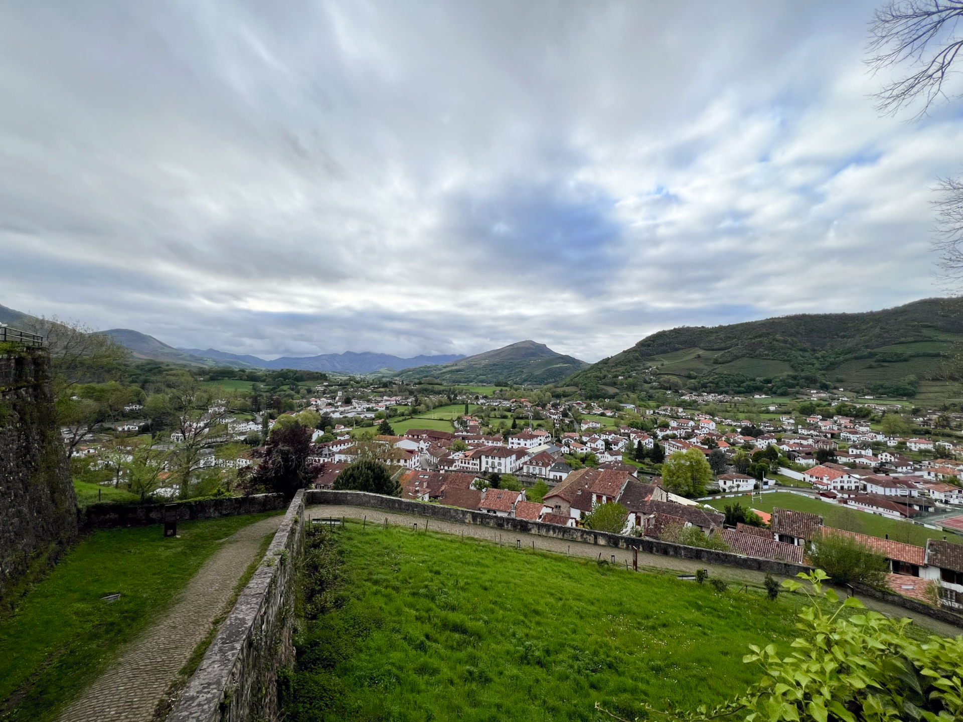
Most international pilgrims begin in Saint-Jean-Pied-de-Port, a small French Basque town near the Spanish border.
However, you can legitimately begin the Camino Francés from many places, including:
- Roncesvalles
- Pamplona
- Logroño
- Burgos
- León
- Astorga
- Ponferrada
- Sarria
There is no spiritual bouncer checking whether you started at the “correct” location.
Some pilgrims walk the entire route in one journey. Others complete it in sections over several years. Many begin in Sarria because it is slightly more than 100 kilometers (62 miles) from Santiago, allowing them to walk the minimum distance generally required to request a Compostela.
Starting in Saint-Jean-Pied-de-Port provides the complete modern Camino Francés experience, but it also throws one of the route’s hardest stages at you almost immediately.
Apparently, the Camino believes in opening with the loudest song.
Camino Francés Route at a Glance
The Camino Francés can be divided into seven broad sections:
- Saint-Jean-Pied-de-Port to Pamplona
- Pamplona to Logroño
- Logroño to Burgos
- Burgos to León across the Meseta
- León to Ponferrada
- Ponferrada to Sarria
- Sarria to Santiago de Compostela
Each section has a different landscape, rhythm, and personality.
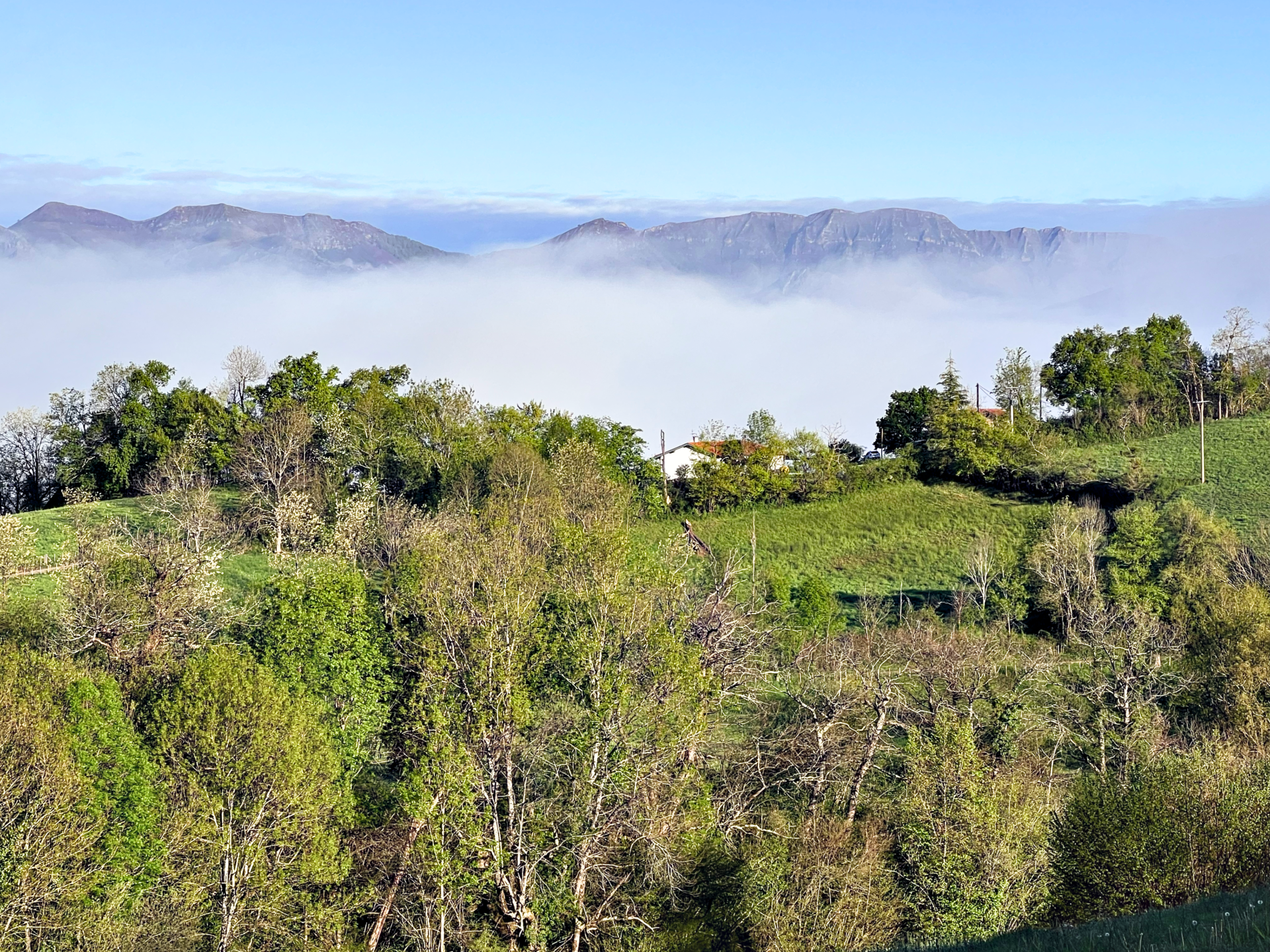
You begin among the steep green mountains of the Pyrenees. You continue through vineyards and historic cities before crossing the wide-open Meseta. Mountains return beyond Astorga and Ponferrada, followed by the green hills, farms, forests, and crowded final stages of Galicia.
It feels less like one continuous trail and more like several journeys stitched together by yellow arrows.
Section One: Crossing the Pyrenees
Saint-Jean-Pied-de-Port to Pamplona
The opening section includes:
- Saint-Jean-Pied-de-Port
- Orisson
- Roncesvalles
- Burguete
- Espinal
- Zubiri
- Trinidad de Arre
- Pamplona
The traditional walk from Saint-Jean-Pied-de-Port to Roncesvalles is approximately 25 kilometers (15.5 miles).
That number does not fully explain the day.
The route climbs from Saint-Jean-Pied-de-Port into the Pyrenees before eventually descending toward Roncesvalles. Depending on the route and mapping method, pilgrims may face more than 1,200 meters (3,937 feet) of cumulative elevation gain.
In other words, it is not merely a 25-kilometer walk.
It is a 25-kilometer introduction to gravity, weather, and the consequences of packing six shirts because they were “lightweight.”
The Napoleon Route and Valcarlos Route
Pilgrims generally encounter two options between Saint-Jean-Pied-de-Port and Roncesvalles.
The Napoleon Route follows the higher mountain path. It offers dramatic views but is more exposed to wind, fog, rain, snow, and rapidly changing conditions.
The Valcarlos Route follows a lower path through the valley. It remains physically demanding, but it avoids the highest section of the Napoleon Route.
The high route is seasonally closed during winter. Even when legally open, poor weather can make it dangerous.
Do not treat the mountain as a personal challenge to your toughness.
The Pyrenees do not care about your step count, motivational playlist, or how much money you paid for waterproof boots.
Follow local instructions.
My First Camino Francés Mistake: Assuming Availability Would Cooperate
I originally hoped to stay at Refuge Orisson after completing the first major climb from Saint-Jean-Pied-de-Port.
That was a lovely plan.
Availability responded with the logistical equivalent of a slammed door.
Refuge Orisson was fully booked.
Before I had even taken my first proper step on the Camino, I needed to improvise.
Fortunately, Saint-Jean-Pied-de-Port offered a Plan B.
Literally.
I booked a room at Plan B Hostel and arranged transportation with Express Bourricot. I could walk from Saint-Jean-Pied-de-Port toward Orisson, return to town, and then travel back to the same area the following morning to continue toward Roncesvalles.
It was not the traditional opening I had imagined.
It was also not a disaster.
The experience taught me something useful before the Camino had properly begun:
A changed plan does not mean a failed Camino.
It simply means the Camino has started editing your script.
Section Two: Navarra and La Rioja
Pamplona to Logroño
After leaving the Pyrenees, the Camino continues through:
- Pamplona
- Alto del Perdón
- Puente la Reina
- Estella
- Villamayor de Monjardín
- Los Arcos
- Viana
- Logroño
This section includes rolling farmland, historic towns, vineyards, exposed paths, and the memorable climb toward Alto del Perdón.
The monument at Alto del Perdón has become one of the Camino Francés’ most recognizable landmarks.
The descent afterward is also memorable, although perhaps not for the same romantic reasons.
Loose rocks and steep slopes can punish knees, ankles, and toes. Trekking poles can help, but slowing down is even more important.
Do not mistake descending for resting.
Gravity is friendly until it repeatedly throws you toward the ground.
Section Three: La Rioja to Burgos
Logroño to Burgos
The route continues through:
- Navarrete
- Nájera
- Azofra
- Santo Domingo de la Calzada
- Belorado
- Villafranca Montes de Oca
- San Juan de Ortega
- Atapuerca
- Burgos
La Rioja is known for vineyards and rolling hills, but do not assume it will always feel gentle.
Long exposed stretches can become difficult in hot weather. Rain can turn otherwise manageable trails into muddy endurance tests.
By this point, the early excitement of the Camino may begin settling into a daily routine:
Wake up.
Pack.
Walk.
Eat.
Wash your clothes badly in a sink.
Hang them somewhere they will almost—but not entirely—dry.
Repeat.
This rhythm can be strangely comforting.
It can also make you forget that your body still needs rest.
Burgos is a strong place to schedule a recovery day. It has restaurants, pharmacies, outdoor stores, transportation connections, and one of Spain’s most spectacular Gothic cathedrals.
Your feet will appreciate the day off.
The cathedral will not complain either.
Section Four: Crossing the Meseta
Burgos to León
The Meseta portion passes through:
- Hornillos del Camino
- Hontanas
- Castrojeriz
- Itero de la Vega
- Frómista
- Carrión de los Condes
- Calzadilla de la Cueza
- Sahagún
- El Burgo Ranero
- Mansilla de las Mulas
- León
Between Burgos and León, much of the Camino crosses a broad plateau of open farmland, long horizons, limited shade, and considerable time alone with your thoughts.
Some pilgrims love the Meseta.
Others skip it.
I would not dismiss it merely because it lacks the dramatic scenery of the Pyrenees or Galicia. Its apparent emptiness is part of its character.
There is nowhere for your mind to hide when the road runs straight toward the horizon.
That can feel peaceful.
It can also feel deeply uncomfortable.
Sometimes, it manages to be both before breakfast.
Meseta Planning Warning
Some stretches between towns have limited food and water services.
Before leaving each morning, check:
- Distance to the next town
- Water availability
- Café and shop hours
- Weather conditions
- Shade
- Accommodation options
Do not assume every village shown on a map contains an operating café.
A dot on your navigation app is not a legally enforceable promise of coffee.
Section Five: León, Astorga, and Cruz de Ferro
León to Ponferrada
Major stops include:
- León
- Villar de Mazarife
- Hospital de Órbigo
- Astorga
- Rabanal del Camino
- Foncebadón
- Cruz de Ferro
- Molinaseca
- Ponferrada
The landscape begins changing again after León.
The route gradually moves away from the broad Meseta and toward the mountains beyond Astorga.
At Cruz de Ferro, many pilgrims leave a stone representing something they wish to release. It is one of the most symbolic locations on the Camino Francés.
The walk afterward includes a long, rocky descent toward Molinaseca.
The views may be spectacular.
Your knees may file a formal complaint.
This is another section where a shorter stage can be wiser than blindly following a traditional itinerary.
Section Six: El Bierzo and the Climb to O Cebreiro
Ponferrada to Sarria
This section passes through:
- Cacabelos
- Villafranca del Bierzo
- Trabadelo
- Las Herrerías
- O Cebreiro
- Triacastela
- Samos
- Sarria
The route through El Bierzo includes vineyards, towns, river valleys, and the major climb toward O Cebreiro.
The final climb from Las Herrerías to O Cebreiro covers only around 9 kilometers (5.6 miles), but it gains hundreds of meters in elevation.
That is why distance alone never tells the full story.
Nine steep kilometers can feel considerably harder than 20 flat kilometers (12.4 miles).
Plan according to terrain, not merely the number displayed beside a stage.
Section Seven: The Final Walk Through Galicia
Sarria to Santiago de Compostela
The final section passes through:
- Sarria
- Portomarín
- Palas de Rei
- Melide
- Arzúa
- O Pedrouzo
- Santiago de Compostela
The route becomes noticeably busier after Sarria.
Many pilgrims begin there because the remaining distance exceeds 100 kilometers (62 miles), which is the minimum walking distance generally associated with requesting the Compostela.
This can be a strange transition for someone who has already walked hundreds of kilometers.
The quieter rhythm suddenly becomes a moving festival of fresh backpacks, large groups, organized tours, and people whose socks have not yet developed personalities.
They are not doing the Camino incorrectly.
They are simply beginning their journey while you are nearing the end of yours.
Traditional Camino Francés Stages
The following is a common 33-stage structure. Distances are approximate because accommodations, town centers, alternate paths, and mapping apps can produce different totals.
| Stage | Route | Distance |
|---|---|---|
| 1 | Saint-Jean-Pied-de-Port to Roncesvalles | 25 km (15.5 miles) |
| 2 | Roncesvalles to Zubiri | 22 km (13.7 miles) |
| 3 | Zubiri to Pamplona | 21 km (13 miles) |
| 4 | Pamplona to Puente la Reina | 24 km (14.9 miles) |
| 5 | Puente la Reina to Estella | 22 km (13.7 miles) |
| 6 | Estella to Los Arcos | 22 km (13.7 miles) |
| 7 | Los Arcos to Logroño | 28 km (17.4 miles) |
| 8 | Logroño to Nájera | 29 km (18 miles) |
| 9 | Nájera to Santo Domingo de la Calzada | 21 km (13 miles) |
| 10 | Santo Domingo to Belorado | 22 km (13.7 miles) |
| 11 | Belorado to San Juan de Ortega | 24 km (14.9 miles) |
| 12 | San Juan de Ortega to Burgos | 26 km (16.2 miles) |
| 13 | Burgos to Hornillos del Camino | 21 km (13 miles) |
| 14 | Hornillos to Castrojeriz | 20 km (12.4 miles) |
| 15 | Castrojeriz to Frómista | 25 km (15.5 miles) |
| 16 | Frómista to Carrión de los Condes | 19 km (11.8 miles) |
| 17 | Carrión to Terradillos de los Templarios | 27 km (16.8 miles) |
| 18 | Terradillos to Bercianos del Real Camino | 23 km (14.3 miles) |
| 19 | Bercianos to Mansilla de las Mulas | 27 km (16.8 miles) |
| 20 | Mansilla de las Mulas to León | 19 km (11.8 miles) |
| 21 | León to Villar de Mazarife | 22 km (13.7 miles) |
| 22 | Villar de Mazarife to Astorga | 31 km (19.3 miles) |
| 23 | Astorga to Foncebadón | 26 km (16.2 miles) |
| 24 | Foncebadón to Ponferrada | 27 km (16.8 miles) |
| 25 | Ponferrada to Villafranca del Bierzo | 24 km (14.9 miles) |
| 26 | Villafranca to O Cebreiro | 28 km (17.4 miles) |
| 27 | O Cebreiro to Triacastela | 21 km (13 miles) |
| 28 | Triacastela to Sarria | 18–25 km (11.2–15.5 miles) |
| 29 | Sarria to Portomarín | 22 km (13.7 miles) |
| 30 | Portomarín to Palas de Rei | 25 km (15.5 miles) |
| 31 | Palas de Rei to Arzúa | 29 km (18 miles) |
| 32 | Arzúa to O Pedrouzo | 19 km (11.8 miles) |
| 33 | O Pedrouzo to Santiago | 20 km (12.4 miles) |
Why I Would Not Blindly Follow the Traditional Stages
Several traditional stages exceed 25 kilometers (15.5 miles).
That may be perfectly manageable for a trained pilgrim with a light backpack.
It may be miserable for someone dealing with:
- Previous injuries
- Blisters
- Joint pain
- Heavy equipment
- Extreme heat
- Poor sleep
- Limited training
- An urgent desire to stop at every bakery in northern Spain
The traditional itinerary is not bad.
It simply assumes a particular pace.
You are allowed to choose another one.
A Slower Camino Francés Strategy
A slower plan might average approximately 15–20 kilometers (9.3–12.4 miles) per day.
Instead of walking directly from Saint-Jean-Pied-de-Port to Roncesvalles, you might divide the opening:
- Saint-Jean-Pied-de-Port to the Orisson area: approximately 8 kilometers (5 miles)
- Orisson area to Roncesvalles: approximately 17 kilometers (10.6 miles)
Instead of walking 28 kilometers (17.4 miles) from Los Arcos to Logroño, you could stop in Viana.
Instead of completing the long traditional stage from Villafranca del Bierzo to O Cebreiro, divide it across:
- Villafranca del Bierzo
- Trabadelo
- Las Herrerías
- O Cebreiro
Instead of walking directly from Palas de Rei to Arzúa, stop around Melide.
This strategy increases the total number of walking days, but it can improve recovery and leave more time to experience the route.
How Long Does the Camino Francés Take?
A conventional itinerary normally takes approximately 33–35 walking days.
However, the complete trip often requires longer once you include:
- Travel to Saint-Jean-Pied-de-Port
- Rest days
- Weather delays
- Injury recovery
- Shortened stages
- Time in Santiago
- Return travel
A realistic range might look like this:
| Walking Style | Average Daily Distance | Approximate Time |
|---|---|---|
| Fast | 25–30 km (15.5–18.6 miles) | 28–33 days |
| Traditional | 20–25 km (12.4–15.5 miles) | 33–40 days |
| Moderate | 15–20 km (9.3–12.4 miles) | 40–50 days |
| Slow | 10–15 km (6.2–9.3 miles) | 50–65 days |
These are planning ranges, not promises.
The better question is not:
“How quickly can I finish the Camino Francés?”
It is:
“What daily pace gives me the best chance of reaching Santiago without turning my pilgrimage into an extended argument with my body?”
How to Plan Your Camino Francés Stages
Begin More Slowly Than You Think Is Necessary
The temptation is to attack the first few stages with enthusiasm.
That enthusiasm may last longer than your feet.
Your body needs time to adjust to:
- Walking daily
- Carrying a backpack
- Repeated climbing and descending
- Hard surfaces
- Shared accommodations
- Early mornings
- Damp clothing
- The realization that tomorrow involves more walking
A 12-kilometer (7.5-mile) day may feel almost too easy during the first week.
That is not failure.
That is prevention.
Plan According to Terrain
Twenty kilometers (12.4 miles) across rolling farmland is not the same as 20 kilometers through the Pyrenees.
Before accepting a stage, check:
- Total distance
- Elevation gain
- Elevation loss
- Trail surface
- Water availability
- Food stops
- Shade
- Weather exposure
- Accommodation choices
A shorter mountain stage may require far more energy than a longer flat stage.
Establish a Distance Range
Instead of setting every overnight stop months in advance, establish a personal distance range.
For example:
- Preferred stage: 15–20 km (9.3–12.4 miles)
- Comfortable maximum: 23 km (14.3 miles)
- Emergency maximum: 27 km (16.8 miles)
- Recovery stage: 8–12 km (5–7.5 miles)
This gives you structure without eliminating flexibility.
You can adjust for weather, fatigue, accommodations, injury, or the discovery of a village where you simply want to stay.
Avoid Planning Every Night in Famous Stage Towns
Guidebooks send large numbers of pilgrims toward the same destinations.
That can mean:
- More competition for beds
- Busier restaurants
- Crowded departures
- Less flexibility
Stopping 3–6 kilometers (1.9–3.7 miles) before or after a traditional endpoint can create a completely different experience.
You may find:
- Quieter accommodations
- Smaller villages
- More personal hospitality
- Shorter lines
- An easier following stage
The Camino exists between the famous towns, not only inside them.
Where to Schedule Rest Days
Rest days are not signs of weakness.
They are maintenance stops for the increasingly unreliable vehicle carrying you to Santiago.
Pamplona
Pamplona is a useful early recovery stop after crossing the Pyrenees.
It offers pharmacies, stores, restaurants, transportation, and enough regular city life to remind you that not everyone spends the morning discussing blisters.
Logroño
Logroño provides food, supplies, and an opportunity to reconsider every unnecessary item inside your backpack.
Burgos
Burgos is one of the best cultural rest stops along the route.
Visit the cathedral, eat properly, and give your legs time to forgive you.
León
León offers history, restaurants, equipment stores, pharmacies, and excellent transportation connections.
It is also positioned before the landscape becomes more mountainous again.
Astorga
Astorga is smaller than León but makes a good recovery stop before Rabanal, Foncebadón, and Cruz de Ferro.
Ponferrada
Ponferrada is a practical place to rest before El Bierzo and the climb toward O Cebreiro.
Sarria
Sarria offers nearly every pilgrim service imaginable, although it can be busy.
It also marks the beginning of a different Camino atmosphere as more walkers join the route.
How Often Should You Rest?
A useful starting point is one rest day after every seven to ten walking days.
You may need more if:
- You develop blisters
- You have previous injuries
- You are sleeping poorly
- Temperatures are unusually high
- Your backpack is heavy
- Your walking form begins changing
- Pain increases instead of improving
You can also schedule short walking days instead of complete rest days.
Walking 8 kilometers (5 miles) to another village maintains momentum while giving your body additional recovery.
Booking Accommodations
Camino accommodations include:
- Municipal albergues
- Parochial albergues
- Private albergues
- Guesthouses
- Pensions
- Hotels
- Rural accommodations
Municipal and Parochial Albergues
These are generally among the least expensive options.
Many provide basic dormitory accommodations and shared bathrooms. Some do not accept reservations.
Expect:
- Bunk beds
- Limited privacy
- Early alarms
- Shared showers
- Snoring with the intensity of experimental industrial music
Private Albergues
Private albergues often accept reservations and may offer:
- Smaller rooms
- Laundry services
- Meals
- Private rooms
- Better charging access
- Slightly less chaos
Guesthouses and Hotels
A private room can be valuable when you need:
- Better sleep
- Injury recovery
- Personal space
- A private bathroom
- One evening without someone reorganizing a plastic bag at 5:00 a.m.
Should You Reserve Every Night?
Probably not, unless:
- You are walking during a busy period
- You require private accommodations
- You have mobility concerns
- You are walking with a group
- You need absolute certainty
- You are staying in towns with limited beds
A balanced strategy is to reserve:
- Your first several nights
- Scarce accommodations
- Popular towns
- Weekends and holidays
- Your arrival in Santiago
- Any stage where your plan depends on one specific property
Leave some later nights flexible.
Your preferred daily distance may change once you begin walking.
Common Camino Francés Planning Mistakes
Packing for Every Possible Disaster
Every object feels insignificant when held alone.
Together, those objects become a studio apartment attached to your spine.
Pack for probable needs rather than every scenario your anxious brain can invent at midnight.
Wearing Untested Footwear
Never begin the Camino in footwear you have not tested on long walks.
Test it:
- On hills
- On descents
- In rain
- With your chosen socks
- With your loaded backpack
- On consecutive days
A shoe can feel wonderful in a store and reveal its villainous personality after 15 kilometers (9.3 miles).
Following Someone Else’s Pace
Camino friendships form quickly.
That does not mean your bodies signed the same walking contract.
Trying to keep up with a faster pilgrim can cause injury. Walking much farther than planned to remain with a group can do the same.
Walk together when it works.
Separate when necessary.
Meet later for food.
Healthy Camino friendships can survive different walking speeds.
Ignoring Small Pain
There is a difference between normal soreness and a developing injury.
Pay attention to:
- Sharp pain
- Increasing swelling
- Pain that changes how you walk
- Hot spots on your feet
- Numbness
- Persistent joint pain
- Pain that gets worse each day
Stopping early for one afternoon is better than being forced to stop for a week.
Planning Without Buffer Days
A tightly scheduled itinerary leaves no space for:
- Weather
- Illness
- Blisters
- Transportation delays
- Accommodation problems
- Emotional fatigue
- Unexpected places you want to explore
Add at least two or three buffer days when possible.
A Camino itinerary without flexibility is just a future argument with a train reservation.
Treating Santiago as the Only Important Place
Reaching Santiago matters.
However, if Santiago becomes the only measure of success, you may rush through the experiences that make the Camino meaningful.
The Camino happens when your body is stiff in the morning.
It happens over shared dinners.
It happens when someone helps you find a bed.
It happens when you walk through a village before anyone else is awake.
Santiago is the destination.
The Camino is everything required to reach it.
What to Carry for the Camino Francés?
Your exact packing list depends on the season, but common essentials include:
- Comfortable, tested footwear
- Lightweight backpack
- Two or three walking outfits
- Warm layer
- Rain protection
- Sleeping liner
- Basic toiletries
- Foot-care supplies
- Water bottles or hydration system
- Sun protection
- Pilgrim credential
- Identification
- Phone and charger
- Required medication
- Trekking poles when appropriate
Backpack weight is personal, but lighter is generally easier.
A pack weighing 7 kilograms (15.4 pounds) feels very different after 25 kilometers (15.5 miles) than it did in your living room.
Before leaving, take several long walks carrying your fully loaded pack.
Your shoulders should learn the truth before arriving in France.
Training for the Camino Francés
You do not need to become an elite athlete.
You should prepare your body for repeated walking.
Training should include:
- Regular walking
- Gradually increasing distance
- Consecutive walking days
- Hill training
- Controlled descents
- Strength work
- Mobility exercises
- Walking with your loaded backpack
One long weekend walk is not the same as walking every day for more than a month.
The challenge is not merely distance.
It is accumulated distance.
A 20-kilometer (12.4-mile) walk may feel manageable.
The real test is how you feel when you need to do it again the following morning.
When to Walk the Camino Francés
Spring
Spring brings green landscapes, moderate temperatures, rain, mud, and changeable mountain weather.
Summer
Summer can bring intense heat, strong sun, crowded accommodations, and exposed walking across the Meseta.
Early starts become especially important.
Autumn
Autumn often offers comfortable temperatures and fewer pilgrims, but daylight decreases and seasonal accommodations begin closing.
Winter
Winter requires additional planning.
Mountain conditions can be dangerous, accommodations become limited, and the Napoleon Route is closed during the official winter restriction period.
Do not assume an albergue will be open merely because it appears on an app.
Call or message ahead when walking outside the primary season.
Creating Your Own Camino Francés Itinerary

Step One: Calculate Your Total Available Time
Include:
- Travel to your starting point
- Walking days
- Rest days
- Buffer days
- Time in Santiago
- Return transportation
Step Two: Determine Your Comfortable Distance
Use actual training walks rather than optimism.
Your body’s real pace matters more than the pace you think looks impressive on a spreadsheet.
Step Three: Identify Difficult Terrain
Shorten days involving:
- Major climbs
- Long descents
- Exposed heat
- Limited services
- Previous injury concerns
Step Four: Add Rest Days Before You Need Them
Do not wait until your body has staged a complete rebellion.
Step Five: Include Buffer Days
Two or three open days can prevent your entire trip from becoming a race after one setback.
Step Six: Reserve Only What Requires Certainty
Secure important accommodations while leaving enough flexibility to respond to the Camino you actually encounter.
Step Seven: Accept That the Plan Will Change
Weather will change.
Beds will fill.
Your energy will rise and fall.
One town will disappoint you.
Another place you barely noticed on the map may become one of your favorite memories.
That is not bad planning.
That is long-distance travel.
Atypical Last Thoughts
The Camino Francés is often described as a route to Santiago, but that explanation feels incomplete.
It is a route through the Pyrenees, Navarra, La Rioja, the Meseta, León, El Bierzo, and Galicia.
It is also a journey through enthusiasm, discomfort, doubt, stubbornness, adaptation, and whatever emotional baggage you packed without realizing it.
Plan your stages.
Research the terrain.
Reserve the beds that genuinely need reserving.
Train your legs.
Break in your footwear.
Lighten your backpack.
Then accept that some part of your beautiful plan will probably collapse.
Mine started changing before I had even left Saint-Jean-Pied-de-Port. Refuge Orisson was unavailable, and my carefully imagined opening became a literal stay at Plan B.
That was not the Camino ruining my journey.
That was the Camino beginning it.
Sometimes, the unavailable bed, changed stage, wrong turn, or forced rest day becomes the story you remember most.
Plan carefully, adventurers and travelers.
But leave enough space for the route to write a few verses of its own.
Buen Camino.
Subscribe
Looking for honest travel inspiration without the polished influencer nonsense?
Join the Atypical Vagabond newsletter for offbeat destination guides, Portugal travel tips, digital nomad lessons, slow travel stories, and the occasional reminder that the ordinary path is wildly overrated.
I share the victories, wrong turns, hidden gems, and real-life chaos that come with building a life around travel. No corporate fluff. No recycled bucket lists. Just useful advice, personal stories, and unconventional adventures designed to help you travel deeper, stay curious, and create your own damn route.
Subscribe and let’s reject the ordinary together.
Donations
Enjoying the stories, guides, videos, and occasional travel disaster here at Atypical Vagabond?
A small donation helps cover the real costs behind the adventures—from transportation and website hosting to camera gear, research, and enough coffee to keep the next guide moving.
There are no giant sponsors pulling the strings and no polished corporate travel machine hiding backstage. Your support helps me continue creating honest travel stories, practical Portugal guides, digital nomad advice, and unconventional adventures for travelers who prefer the road less rehearsed.
Every contribution helps keep Atypical Vagabond independent.
Fuel the next adventure through PayPal—and help me keep rejecting the ordinary.
Leave a Reply