Planning a Camino Francés itinerary looks suspiciously simple when you first see it on a map.
Start in Saint-Jean-Pied-de-Port. Follow the yellow arrows across northern Spain. Walk into Santiago de Compostela approximately 790 kilometers—or 490 miles—later. Collect your Compostela. Limp triumphantly toward the nearest café.
Easy, right?
Then you put on a backpack and discover that maps do not show blisters, steep descents, questionable weather, full albergues, aching knees, or the emotional crisis that can occur when the next café is still 8 kilometers away.
The Camino Francés is traditionally divided into approximately 33 walking stages. Many pilgrims complete the full route in 30 to 35 days, but that does not mean you must follow the traditional schedule like it was carved into a stone tablet by Saint James himself.
This guide covers the complete Camino Francés route from Saint-Jean-Pied-de-Port to Santiago de Compostela, including daily distances, challenging sections, recommended rest stops, accommodation advice, and ways to create a slower itinerary.
Use it as a framework rather than a commandment.
The Camino is already going to tell you what to do often enough.
Camino Francés Route at a Glance
| Route detail | Information |
|---|---|
| Starting point | Saint-Jean-Pied-de-Port, France |
| Finishing point | Santiago de Compostela, Spain |
| Approximate distance | 790 kilometers or 490 miles |
| Traditional walking stages | Approximately 33 |
| Typical walking time | 30–35 days |
| Comfortable schedule with rest days | 38–45 days |
| Slow itinerary | 50–60 days |
| Major regions | French Basque Country, Navarra, La Rioja, Castilla y León, and Galicia |
| Major cities | Pamplona, Logroño, Burgos, León, Astorga, and Ponferrada |
| Common accommodation | Public albergues, private albergues, pensions, guesthouses, and hotels |
| Main route markers | Yellow arrows and scallop-shell symbols |
| Most popular shorter section | Sarria to Santiago de Compostela |
The exact Camino Francés distance changes slightly depending on route variants, accommodation choices, detours, and how often you wander into a village searching for coffee.
That is why some guidebooks list the route at roughly 760 kilometers, while others place it closer to 800 kilometers. For practical planning, I use approximately 790 kilometers or 490 miles.
How Long Does the Camino Francés Take?
Most traditional itineraries divide the Camino Francés into 33 walking days averaging roughly 20 to 25 kilometers per day.
That schedule works for experienced walkers with limited time. It is not automatically the best schedule for everyone.
A more realistic breakdown looks like this:
| Itinerary style | Walking days | Rest days | Total time |
|---|---|---|---|
| Fast Camino | 28–30 | 0–2 | 29–32 days |
| Traditional Camino | 32–34 | 2–4 | 34–38 days |
| Comfortable Camino | 35–40 | 4–6 | 40–46 days |
| Slow Camino | 45–55 | 5–8 | 50–60 days |
The best itinerary depends on your fitness, available time, pack weight, injuries, preferred accommodation, and whether you want to explore the cities rather than merely stagger through them.
There is no prize for completing the Camino faster.
There is only laundry.
My First Camino Francés Itinerary Lesson

My original plan was to walk from Saint-Jean-Pied-de-Port to Orisson and stay at Refuge Orisson.
The Camino immediately reviewed that plan, laughed, and rejected it.
Refuge Orisson was fully booked.
Fortunately, Saint-Jean-Pied-de-Port had a Plan B.
Literally.
I stayed at Plan B Hostel and arranged transportation with Express Bourricot. I walked the steep first section toward Orisson, returned to Saint-Jean-Pied-de-Port, and continued from the same point the following day.
It involved more logistical choreography, but splitting the Pyrenees crossing was one of the smartest decisions I made.
The climb from Saint-Jean-Pied-de-Port toward Orisson is only around 8 kilometers, or 5 miles, but it gains elevation relentlessly. I was carrying approximately 12 kilograms, or 25 pounds, and quickly began reconsidering every object I had packed.
That first section taught me something important: your itinerary should serve your body, not your ego.
Complete 33-Stage Camino Francés Itinerary
There is no single legally binding division of the Camino Francés stages. Guidebooks use slightly different endpoints, and pilgrims regularly adjust their days based on weather, injuries, accommodation, and how much they enjoyed the previous evening’s vino tinto.
The following itinerary provides a practical 33-stage framework.
All distances are approximate.
| Stage | Route | Distance |
|---|---|---|
| 1 | Saint-Jean-Pied-de-Port to Roncesvalles | 25 km / 15.5 mi |
| 2 | Roncesvalles to Zubiri | 22 km / 13.7 mi |
| 3 | Zubiri to Pamplona | 22 km / 13.7 mi |
| 4 | Pamplona to Puente la Reina | 24 km / 14.9 mi |
| 5 | Puente la Reina to Estella | 21.5 km / 13.4 mi |
| 6 | Estella to Los Arcos | 22 km / 13.7 mi |
| 7 | Los Arcos to Logroño | 28 km / 17.4 mi |
| 8 | Logroño to Navarrete | 12 km / 7.5 mi |
| 9 | Navarrete to Azofra | 23 km / 14.3 mi |
| 10 | Azofra to Grañón | 22 km / 13.7 mi |
| 11 | Grañón to Villafranca Montes de Oca | 28 km / 17.4 mi |
| 12 | Villafranca Montes de Oca to Cardeñuela Riopico | 24.5 km / 15.2 mi |
| 13 | Cardeñuela Riopico to Tardajos, via Burgos | 25.5 km / 15.8 mi |
| 14 | Tardajos to Castrojeriz | 30 km / 18.6 mi |
| 15 | Castrojeriz to Frómista | 25 km / 15.5 mi |
| 16 | Frómista to Carrión de los Condes | 20 km / 12.4 mi |
| 17 | Carrión de los Condes to Terradillos de los Templarios | 26 km / 16.2 mi |
| 18 | Terradillos de los Templarios to Bercianos del Real Camino | 24 km / 14.9 mi |
| 19 | Bercianos del Real Camino to Mansilla de las Mulas | 27 km / 16.8 mi |
| 20 | Mansilla de las Mulas to León | 19 km / 11.8 mi |
| 21 | León to Villar de Mazarife | 21 km / 13 mi |
| 22 | Villar de Mazarife to Astorga | 31 km / 19.3 mi |
| 23 | Astorga to Foncebadón | 26 km / 16.2 mi |
| 24 | Foncebadón to Ponferrada | 27 km / 16.8 mi |
| 25 | Ponferrada to Villafranca del Bierzo | 24 km / 14.9 mi |
| 26 | Villafranca del Bierzo to O Cebreiro | 28 km / 17.4 mi |
| 27 | O Cebreiro to Triacastela | 20 km / 12.4 mi |
| 28 | Triacastela to Sarria | 25.5 km / 15.8 mi |
| 29 | Sarria to Portomarín | 22 km / 13.7 mi |
| 30 | Portomarín to Palas de Rei | 25.1 km / 15.6 mi |
| 31 | Palas de Rei to Arzúa | 29.1 km / 18.1 mi |
| 32 | Arzúa to O Pedrouzo | 18.4 km / 11.4 mi |
| 33 | O Pedrouzo to Santiago de Compostela | 20.2 km / 12.6 mi |
This schedule contains several long days. Do not be afraid to split them.
Thirty kilometers on a spreadsheet is a number. Thirty kilometers after three weeks of walking can feel like a personal dispute between you and the universe.
Camino Francés Route by Region
The Camino Francés does not feel like one continuous landscape. The terrain, food, architecture, climate, and atmosphere change dramatically as you cross northern Spain.
Understanding those changes makes the route easier to plan.
Saint-Jean-Pied-de-Port and the Pyrenees
Stage 1: Saint-Jean-Pied-de-Port to Roncesvalles
The traditional first stage is one of the most demanding days of the entire Camino Francés.
That seems slightly rude.
Pilgrims leaving Saint-Jean-Pied-de-Port generally choose between two routes:
- The higher Napoleon Route
- The lower route through Valcarlos
The Napoleon Route delivers the sweeping Pyrenees scenery most people have seen in photographs. It also involves a long, steep climb followed by a serious descent into Roncesvalles.
The route reaches Col de Lepoeder at approximately 1,430 meters before descending toward Roncesvalles at around 950 meters.
That descent deserves respect. Loose rocks, tired legs, mud, and steep gradients can create an impressive recipe for landing on your backside.
I managed a few slips myself. The mountain did not applaud, but it probably wanted to.
The Napoleon Route is closed during the official winter closure from November 1 through March 31. Pilgrims traveling during that period must use the Valcarlos route. Weather can also make the higher route unsafe outside those dates, so check conditions in Saint-Jean-Pied-de-Port before leaving.
Should You Split the First Stage?
For many pilgrims, yes.
Saint-Jean-Pied-de-Port to Orisson is approximately 8 kilometers, or 5 miles. Orisson to Roncesvalles is approximately 17 kilometers, or 10.5 miles.
Splitting the stage allows you to tackle the steep opening climb without immediately forcing your body through a full mountain crossing.
However, accommodation near Orisson is limited and books quickly. Reserve well in advance or investigate transportation arrangements that let you divide the walk while staying in Saint-Jean-Pied-de-Port.
This is especially valuable for beginners, older walkers, anyone carrying a heavier backpack, or pilgrims planning a slower Camino Francés itinerary.
Navarra: Roncesvalles to Viana
After the Pyrenees, the Camino continues through forests, small villages, farmland, and historic towns across Navarra.
Important stops include:
- Roncesvalles
- Zubiri
- Pamplona
- Puente la Reina
- Estella
- Los Arcos
- Viana
The trail may become less dramatic after the mountain crossing, but it does not become flat immediately.
The descent toward Zubiri can be difficult on knees and ankles, particularly in wet conditions. Trekking poles earn their place here.
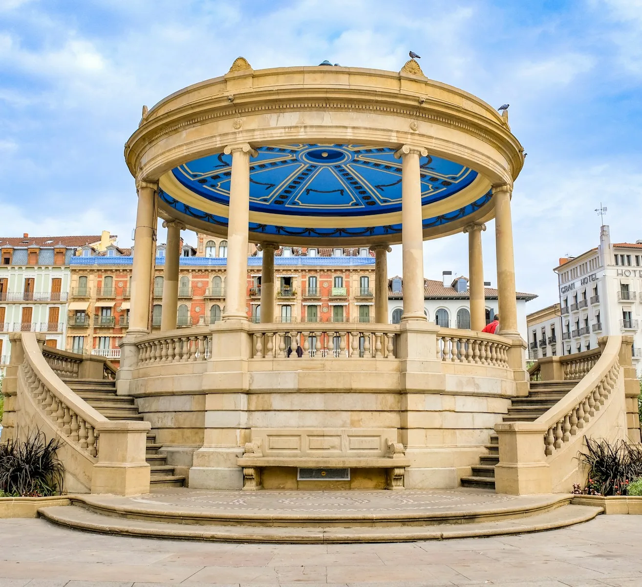
Pamplona is the first major city on the route and an excellent place to slow down. After several days of shared dormitories and trail meals, arriving somewhere with pharmacies, restaurants, laundry services, and actual city streets can feel wonderfully civilized.
The walk from Pamplona to Puente la Reina crosses Alto del Perdón, where the famous metal pilgrim sculptures stand against the skyline.
It is one of the iconic views of the Camino Francés—and another place where wind may attempt to relocate you.
La Rioja: Logroño to Grañón
The route enters La Rioja near Logroño and continues through vineyards, rolling agricultural land, and towns closely connected to the history of the Camino.
Major stops include:
- Logroño
- Navarrete
- Nájera
- Azofra
- Santo Domingo de la Calzada
- Grañón
Logroño deserves more than an exhausted shower and an early bedtime. It is known for its food, wine, and lively streets, making it another strong candidate for a rest day.
However, the stages around La Rioja can become hot and exposed. Shade is not always available, and small villages may close services during the afternoon.
Carry enough water, especially during warmer months.
This is also where the excitement of the first week begins colliding with the repetitive reality of walking every day.
Wake up. Pack. Walk. Eat. Wash clothes. Search for a place to charge your phone. Attempt to remember which bunk is yours.
Repeat.
The repetition can feel monotonous, but it is also where the rhythm of the Camino begins taking over.
Burgos and the Meseta
Burgos marks a major transition.
The Camino enters the Meseta, the broad plateau stretching across much of Castilla y León. Some pilgrims love it. Others consider skipping it. The Meseta does not care either way.
The landscape becomes open, exposed, and horizontal. Villages may be farther apart, trees become occasional celebrities, and the horizon appears to move backward while you walk toward it.
Important stops include:
- Burgos
- Tardajos
- Hornillos del Camino
- Castrojeriz
- Frómista
- Carrión de los Condes
- Terradillos de los Templarios
- Sahagún
- Mansilla de las Mulas
Should You Skip the Meseta?
I would not skip it automatically.
The Meseta is not visually dramatic in the same way as the Pyrenees or Galicia, but it is an important part of the Camino Francés experience.
The stillness creates space for thought. Sometimes too much thought.
Without constant scenery competing for your attention, the Camino becomes less about what you are looking at and more about what is rattling around inside your head.
That can be peaceful.
It can also feel like being trapped in a very long therapy session with yourself.
The Meseta also brings practical challenges. Long distances between services, strong sun, wind, and limited shade require better water planning. Starting early can help you avoid the worst afternoon heat.
Resting in Burgos
Burgos is one of the best rest-day locations on the entire route.
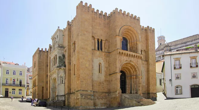
The city offers accommodation in several price ranges, restaurants, pharmacies, transportation links, and one of Spain’s great Gothic cathedrals.
A rest day does not have to mean lying motionless while staring at your feet.
Although that remains a respectable option.
Use the time to wash clothing properly, replace worn equipment, explore the historic center, and allow irritated muscles to calm down before entering the Meseta.
León, Astorga, and the Montes de León
León is another major milestone and one of the most rewarding cities on the Camino Francés route.
After days crossing the Meseta, the city feels energetic, historic, and almost overwhelmingly full of choices.
Important stops in this section include:
- León
- Villar de Mazarife
- Hospital de Órbigo
- Astorga
- Rabanal del Camino
- Foncebadón
- Cruz de Ferro
- Ponferrada
The Camino gradually leaves the flat plateau and climbs toward the Montes de León.
Near Foncebadón, pilgrims reach Cruz de Ferro, one of the route’s most symbolic locations. Many walkers carry a stone from home and leave it at the base of the cross to represent a burden, memory, prayer, or part of life they are prepared to release.
It is a simple ritual, but the pile of stones makes it clear how many people arrived carrying something invisible.
The following descent toward Ponferrada can be difficult. Even strong walkers may find prolonged downhill sections harder than climbing.
Shorten the stage when your knees begin filing formal complaints.
El Bierzo and the Climb to O Cebreiro
Ponferrada introduces pilgrims to El Bierzo, a region of vineyards, mountains, historic villages, and increasingly green scenery.
The major route passes through:
- Ponferrada
- Cacabelos
- Villafranca del Bierzo
- Las Herrerías
- La Faba
- O Cebreiro
The climb from Villafranca del Bierzo to O Cebreiro is widely considered one of the toughest stages of the Camino Francés.
The steepest climbing arrives late in the day, after Las Herrerías, when your legs may already be tired.
That is exactly when the mountain begins behaving like a punk venue that has decided the encore should be louder than the entire show.
A better approach is to divide this stage.
Possible stopping points include towns before or during the climb, depending on accommodation availability. Breaking the ascent gives you more time to enjoy the mountains rather than simply surviving them.
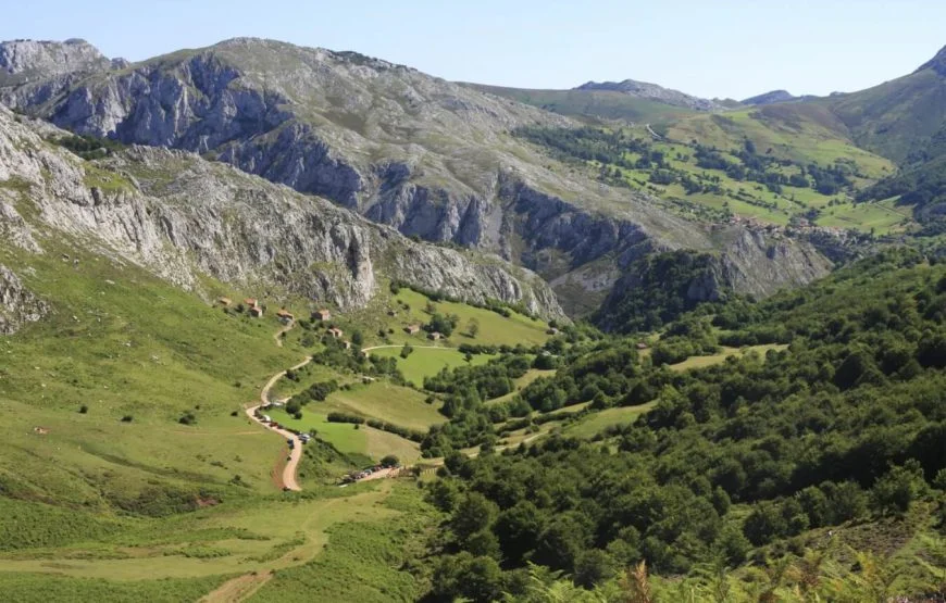
O Cebreiro marks your entrance into Galicia. The village is famous for its mountain setting, stone buildings, and traditional pallozas.
It can also deliver fog, wind, rain, and rapidly changing conditions.
Galicia likes atmosphere.
Galicia: O Cebreiro to Santiago
The Camino changes again after O Cebreiro.
The route moves through green hills, forests, stone villages, farms, narrow lanes, and rolling terrain toward Santiago de Compostela.
Important stops include:
- Triacastela
- Sarria
- Portomarín
- Palas de Rei
- Melide
- Arzúa
- O Pedrouzo
- Santiago de Compostela
At Triacastela, pilgrims can choose between route variants toward Sarria. One option passes through San Xil, while the longer alternative travels through Samos and its monastery.
Both eventually rejoin before Sarria.
Sarria is the most popular starting point on the Camino Francés because it allows pilgrims to complete the final qualifying distance into Santiago within approximately one week.
As a result, the Camino becomes noticeably busier after Sarria.
Pilgrims who have already crossed Spain sometimes react to the new arrivals with irritation. It is easy to forget that everyone begins somewhere.
Besides, the walkers starting in Sarria are still voluntarily choosing several days of hills, rain, communal bathrooms, and foot maintenance.
They have earned at least a friendly “Buen Camino.”
The Final Five Camino Francés Stages
Sarria to Portomarín: 22 Kilometers or 13.7 Miles
The trail leaves Sarria through countryside, forests, farms, and small settlements.
This stage passes the official 100-kilometer marker, although route changes and different measurements can make individual markers feel inconsistent.
Portomarín sits above a reservoir. The original settlement was relocated when the valley was flooded, and several historic buildings were moved stone by stone.
The staircase leading into town provides one final insult to tired legs.
Portomarín to Palas de Rei: 25.1 Kilometers or 15.6 Miles
The stage begins with climbing and continues through a combination of woodland, rural communities, and road-adjacent sections.
It is not the steepest day, but the repeated rolling terrain adds up.
This is where “only five days left” begins sounding both encouraging and slightly terrifying.
Palas de Rei to Arzúa: 29.1 Kilometers or 18.1 Miles
This is one of the longest stages in the traditional final section.
Many pilgrims divide it by staying in Melide, which creates two shorter stages of approximately 14 to 15 kilometers each.
Melide is also known for pulpo, or octopus, which provides an excellent excuse to stop.
Not that you need to justify stopping.
Your feet already submitted the paperwork.
Arzúa to O Pedrouzo: 18.4 Kilometers or 11.4 Miles
The route continues through forests, farms, and small communities.
This shorter stage gives pilgrims a chance to preserve energy before the final walk into Santiago.
O Pedrouzo is a practical Camino stop with plenty of pilgrim services, although its atmosphere is more functional than romantic.
At this point, romance is optional. A clean bed is poetry.
O Pedrouzo to Santiago: 20.2 Kilometers or 12.6 Miles
The final day passes near Santiago’s airport before climbing toward Monte do Gozo.
From there, pilgrims begin entering the outskirts of Santiago.
Do not expect the cathedral to appear immediately in a cloud of heavenly light.
First come roads, buildings, neighborhoods, traffic, and the slow realization that the journey is genuinely ending.
Eventually, the route enters the historic center and reaches the Cathedral of Santiago de Compostela.
After hundreds of kilometers, the arrival can feel triumphant, surreal, emotional, anticlimactic, or all four at once.
The Camino is rarely polite enough to deliver only one emotion.
How to Create a Slow Camino Francés Itinerary
A slow Camino Francés itinerary is not simply the standard route with additional rest days.
It requires changing the walking stages themselves.
Walking an average of 10 to 15 kilometers per day can turn the Camino Francés into a journey lasting approximately 50 to 60 days. However, accommodation is not available at perfectly spaced intervals throughout the route.
Some days may remain closer to 18 kilometers, while others can be shortened to 8 or 10.
The trick is to plan around villages with reliable accommodation rather than forcing every stage to match the same distance.
Split the Hardest Stages First
These stages are strong candidates for division:
- Saint-Jean-Pied-de-Port to Roncesvalles
- Los Arcos to Logroño
- Grañón to Villafranca Montes de Oca
- Tardajos to Castrojeriz
- Villar de Mazarife to Astorga
- Foncebadón to Ponferrada
- Villafranca del Bierzo to O Cebreiro
- Triacastela to Sarria
- Palas de Rei to Arzúa
Splitting long mountain days and extended stages is more valuable than dividing an easy 20-kilometer day merely to maintain a numerical average.
Build Flexibility Into the Schedule
Do not reserve every night of a 60-day Camino before leaving home.
A fully booked schedule may feel secure, but it eliminates your ability to respond to injuries, weather, friendships, fatigue, and unexpected discoveries.
A balanced approach is to reserve the most difficult locations while leaving some intermediate stages flexible.
Consider booking ahead for:
- Saint-Jean-Pied-de-Port
- The Orisson area
- Roncesvalles
- Major holidays or festival dates
- Small mountain villages
- Sarria to Santiago during busy periods
- Private rooms on planned rest days
The Camino often works best with a plan written in pencil.
Preferably not the tiny pencil you packed because someone online told you every gram matters.
Best Rest Days on the Camino Francés
Rest days are not evidence of weakness. They are maintenance.
A full rest day every seven to ten walking days works well for many pilgrims.
Pamplona
Pamplona is a logical early rest point, especially after crossing the Pyrenees.
It offers excellent food, historic streets, pharmacies, outdoor shops, and enough services to fix problems discovered during the opening stages.
Logroño
Logroño is ideal for travelers interested in food and wine.
It is also a useful place to reassess your equipment before the Camino moves deeper into Castilla y León.
Burgos
Burgos is perhaps the best strategic rest day before the Meseta.
Explore the cathedral, eat something substantial, and give your legs a chance to recover.
León
León provides a natural psychological break after the Meseta.
It is also worth visiting in its own right, rather than seeing only the inside of an albergue and the nearest supermarket.
Ponferrada
Ponferrada makes a useful recovery stop before the climb toward O Cebreiro.
Its Templar castle and historic center provide more interesting scenery than the ceiling above your bunk.
Sarria
A rest day in Sarria can prepare you for the busier final section.
It also gives you time to confirm accommodation and organize the remaining stages into Santiago.
Camino Francés Accommodation
The Camino Francés has the most developed accommodation network of the major Camino de Santiago routes.
Common options include:
Public Albergues
Public or municipal albergues usually offer simple dormitory accommodation at lower prices.
Facilities vary. Expect bunk beds, shared bathrooms, limited privacy, and the occasional symphony of snoring.
Some accept reservations, while others operate on a first-come basis.
Private Albergues
Private albergues often provide additional amenities, smaller rooms, reservation options, laundry services, or communal meals.
They are usually more expensive than municipal accommodation but can provide greater flexibility.
Pensions and Guesthouses
Pensions offer private rooms and are helpful when you need deeper sleep, privacy, or a break from dormitory life.
After enough nights in shared rooms, closing a private door can feel like being granted a small kingdom.
Hotels
Hotels are available in larger towns and cities. They work well for rest days, injury recovery, romantic breaks, or the occasional reminder that towels can be larger than a handkerchief.
Should You Reserve Accommodation?
That depends on your season, walking speed, and tolerance for uncertainty.
Reserve ahead when:
- Walking during busy spring or autumn periods
- Staying in small villages with limited beds
- Splitting the Pyrenees crossing
- Requiring a private room
- Walking the final stages after Sarria
- Arriving late in the day
- Traveling with a group
Remaining flexible is easier during quieter periods or when you are comfortable using dormitories.
Is the Camino Francés Good for Beginners?
The Camino Francés is suitable for beginners, but it should not be confused with an easy vacation.
Its advantages include:
- Frequent route markers
- Numerous accommodation options
- Regular cafés and food services
- A large pilgrim community
- Public transportation from many major towns
- Access to pharmacies and medical services
- Several opportunities to shorten or divide stages
Its main challenges include:
- The Pyrenees crossing
- Long daily distances
- Steep descents
- Heat and exposure on the Meseta
- The climb to O Cebreiro
- Repetitive strain from walking every day
- The temptation to carry far too much
A beginner can absolutely walk the Camino Francés.
A beginner who trains, packs sensibly, and allows enough time will enjoy it considerably more.
Pilgrim Credential and Compostela Requirements
The pilgrim credential is the passport of the Camino.
Pilgrims collect stamps from albergues, churches, cafés, hotels, tourist offices, and other locations along the route.
The credential serves two practical purposes:
- It identifies you as a pilgrim and may provide access to pilgrim accommodation.
- It documents your route when applying for the Compostela in Santiago.
Pilgrims walking the qualifying final section should collect at least two stamps per day during the final 100 kilometers.
To request the Compostela, walkers must complete at least the final 100 kilometers into Santiago on a recognized route. Cyclists must complete at least the final 200 kilometers.
The traditional starting point for the qualifying final walking section of the Camino Francés is Sarria or nearby Barbadelo.
Keep your credential somewhere dry.
Few things say “spiritual transformation” like presenting the Pilgrim Office with a papier-mâché accordion that spent four days absorbing Galician rain.
What Is the Best Time to Walk the Camino Francés?
Spring and early autumn generally offer the best balance of weather, available services, and manageable crowds.
April to June
Spring brings green landscapes, cooler temperatures, wildflowers, and a strong possibility of rain.
Mountain conditions can still be unpredictable, especially early in the season.
July and August
Summer offers long daylight hours and generally open services, but temperatures can become intense across exposed sections.
The Meseta can be particularly hot.
Begin walking early, carry sufficient water, and avoid relying on a fountain that may be dry.
September and October
Early autumn can provide comfortable walking temperatures, active pilgrim services, and changing colors.
Days become shorter later in the season, and some accommodations begin closing.
November to March
Winter walking requires more experience and planning.
Many accommodations and cafés close, mountain weather becomes more dangerous, daylight is limited, and the Napoleon Route is closed from November 1 through March 31.
The Valcarlos route remains the appropriate alternative for the opening stage during the winter closure.
Do You Need a Camino Francés Map?
The Camino Francés is generally well marked with yellow arrows and scallop-shell symbols.
However, you should still carry an offline map or navigation app.
Markers can be missed when:
- Leaving cities
- Walking before sunrise
- Following temporary diversions
- Passing through construction
- Talking to another pilgrim instead of watching the trail
- Confidently following someone who is also lost
A downloadable Camino Francés map or GPX track provides useful backup, particularly around urban areas and route variants.
Just remember that following a digital line is not a substitute for checking official closures, local warnings, or mountain weather.
Frequently Asked Questions About the Camino Francés Itinerary
How many days do you need for the Camino Francés?
Most pilgrims need approximately 30 to 35 walking days. Adding four to six rest days creates a more comfortable itinerary of around 38 to 42 days.
A slow itinerary can take 50 to 60 days.
How long is the Camino Francés?
The complete Camino Francés from Saint-Jean-Pied-de-Port to Santiago is approximately 790 kilometers, or 490 miles.
The exact total varies according to route choices and detours.
How many stages are on the Camino Francés?
The route is commonly divided into 33 stages.
However, those stages are planning conventions rather than mandatory daily distances. You may divide or combine them according to your pace.
Where does the Camino Francés begin?
The most recognized international starting point is Saint-Jean-Pied-de-Port in France.
Some pilgrims begin in Roncesvalles, Pamplona, Burgos, León, Ponferrada, or Sarria.
What is the hardest Camino Francés stage?
Saint-Jean-Pied-de-Port to Roncesvalles is often considered one of the hardest because of its long climb and steep descent across the Pyrenees.
Villafranca del Bierzo to O Cebreiro and Foncebadón to Ponferrada can also be demanding.
Can you walk only part of the Camino Francés?
Yes. Many pilgrims complete the route in sections over several years.
Popular sections include:
- Saint-Jean-Pied-de-Port to Pamplona
- Pamplona to Logroño
- Logroño to Burgos
- Burgos to León
- León to Ponferrada
- Ponferrada to Sarria
- Sarria to Santiago
Is Sarria to Santiago really 100 kilometers?
The commonly walked route from Sarria to Santiago is longer than 100 kilometers, with estimates generally ranging from approximately 110 to 115 kilometers.
Starting in Sarria provides enough distance to meet the walking requirement for the Compostela.
How much should my backpack weigh?
Carry the lightest pack that still allows you to travel safely and comfortably.
Instead of obsessing over one universal percentage, test your loaded backpack during training. Walk consecutive days with it and pay attention to your shoulders, back, hips, knees, and feet.
My roughly 12-kilogram, or 25-pound, backpack taught me very quickly that everything feels light while standing in a bedroom.
Mountains conduct more honest product reviews.
How often should you take a rest day?
One rest day every seven to ten walking days is a practical starting point.
Take one sooner when pain changes your stride, affects your balance, or becomes worse each day.
A rest day costs less time than an injury.
Atypical Last Thoughts
A good Camino Francés itinerary provides direction without trapping you inside a rigid schedule.
The traditional 33 stages offer a useful framework, but the Camino does not care how neatly your plans fit into a spreadsheet.
Weather changes. Accommodation fills. Feet swell. Friendships form. Villages surprise you. Some mornings you feel capable of walking forever, while other mornings putting on your socks feels like an unreasonable demand.
Plan the route. Study the difficult sections. Reserve the places where accommodation is limited. Build in rest days. Then leave enough room for the Camino to become something other than the trip you imagined.
My first lesson arrived before I had even crossed the Pyrenees: Plan A will not always survive.
Fortunately, the Camino is rather good at Plan B.
Buen Camino.
Meet Carter

I’m Carter, an American traveler living in Portugal and the creator of Atypical Vagabond. After selling my technology business, I traded the conventional path for slow travel, life abroad, and a slightly unreasonable number of long walks across Europe. I share honest Portugal guides, Camino stories, digital nomad advice, and practical lessons to help you explore the world with greater confidence and purpose.
Subscribe
Looking for honest travel inspiration without the polished influencer nonsense?
Join the Atypical Vagabond newsletter for offbeat destination guides, Portugal travel tips, digital nomad lessons, slow travel stories, and the occasional reminder that the ordinary path is wildly overrated.
I share the victories, wrong turns, hidden gems, and real-life chaos that come with building a life around travel. No corporate fluff. No recycled bucket lists. Just useful advice, personal stories, and unconventional adventures designed to help you travel deeper, stay curious, and create your own damn route.
Subscribe and let’s reject the ordinary together.
Donations
Enjoying the stories, guides, videos, and occasional travel disaster here at Atypical Vagabond?
A small donation helps cover the real costs behind the adventures—from transportation and website hosting to camera gear, research, and enough coffee to keep the next guide moving.
There are no giant sponsors pulling the strings and no polished corporate travel machine hiding backstage. Your support helps me continue creating honest travel stories, practical Portugal guides, digital nomad advice, and unconventional adventures for travelers who prefer the road less rehearsed.
Every contribution helps keep Atypical Vagabond independent.
Fuel the next adventure through PayPal—and help me keep rejecting the ordinary.
Leave a Reply